Bataan National Park
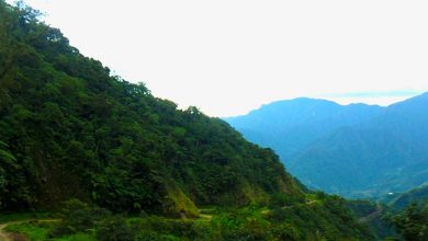
Bordering Manila Bay in the east and South China Sea on the southwest is 23,668 ha island known as Bataan Peninsula. This island is surrounded by jungle and traversed by steep mountains from north to south. It consists of 12 municipalities: Balanga (provincial capital); Abucay; Bagac; Dinalupihan; Hermosa; Limay; Mariveles; Morong; Orani; Orion; Pilar; and Samal. In 1945 the entire peninsula was declared as a National Park.
Bataan covered by luxuriant vegetation is a home of a large number of cagey wild monkeys and other variety of insects and birds and species of fish. Mt. Natib has an elevation of 4,224 ft above sea level is the highest peak in the peninsula. Various varieties of flowers including ground orchids are present in the area. Along the valley of Mt. Natib is the Pasukulan Falls, a magnificent waterfalls surrounded by lush green.
Some of the attraction in the area are the Roosevelt National Park, the forest reserved area serves as a picnic ground and camp site to the visitors; the Sanctuary of Our Lady of the Holy Rosary; The Sibul spring, a recreation area with natural spring and sulfuric swimming pool; the Pasukulan and Dunsulan Falls, enchanting attractions at the heart of the forests; the export processing zone; the Talaga beach; Balon Anito hot spring; First Abucay Catholic Church, the site of the fierce battle of Dutch and Natives; and the Marker of the first strong line of defense at Dinalupihan, an area that commemorates the event of the World War II. Some of the things that will caught one’s attention are the bomb-twisted Lorch Dock, Malinta Tunnel complex that serves as a headquarter during the war, Mile-long Barracks, the pre-war headquarter of the American garrison and Pacific War Memorial Museum.


